The 3D tools you need
Quick Terrain Modeler is the world’s premier 3D point cloud and terrain visualization software package. Designed for use with LiDAR, but flexible enough to accommodate any 3D data source, Quick Terrain Modeler provides an easy to use software experience that allows users to work with significantly more data, render larger models, analyze data faster, and export a wider variety of products than any other tool. These benefits enable very powerful, yet simple and intuitive, 3D exploitation.
Visualize
Create your 3D scene
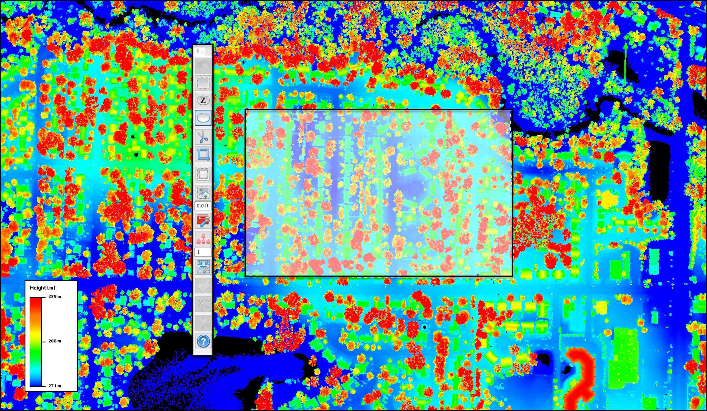
Quick Terrain Modeler allows you to visualize vast amounts of 3D data – in point cloud, and/or surface model formats – interactively and seamlessly. QTM converts coordinates and vertical datums on the fly, so feel free to load data from a variety of sources, in a variety of resolutions and coordinate systems, into the same scene. Once you have the 3D data loaded, you can drape 2D imagery on top (file-based or from WMS), customize elevation palettes, set lighting direction, cast virtual shadows, add contour lines, and many other visualization options. Images on right: Point cloud with color imagery (left side) and height coloration (right side). Use slider to compare.
Inspect
Fast tools to assess data
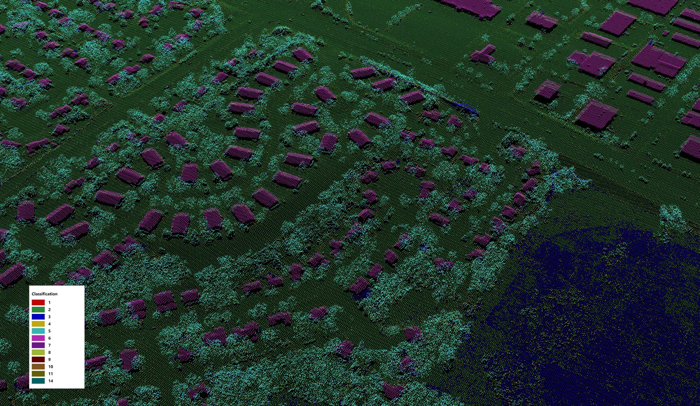
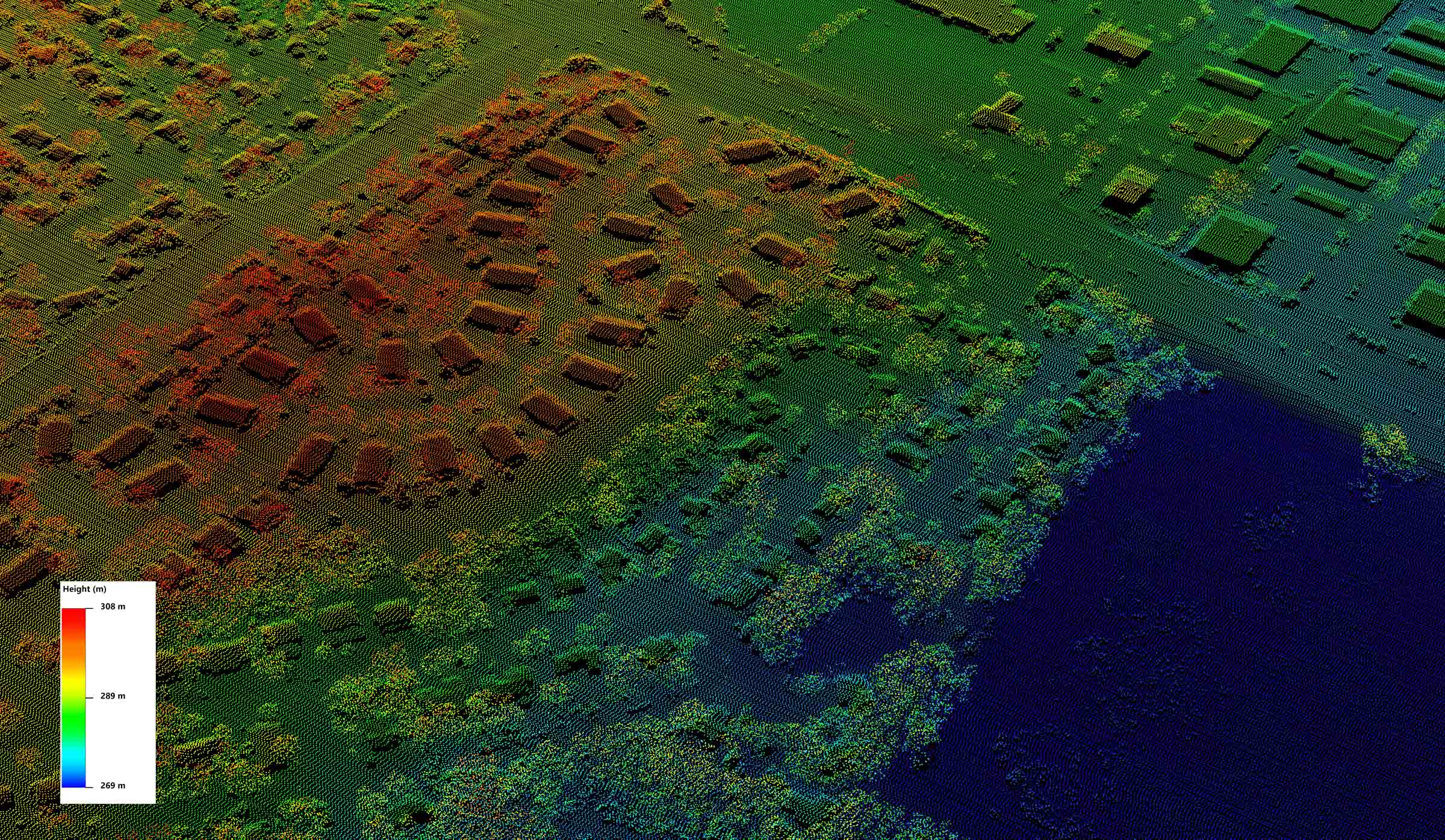
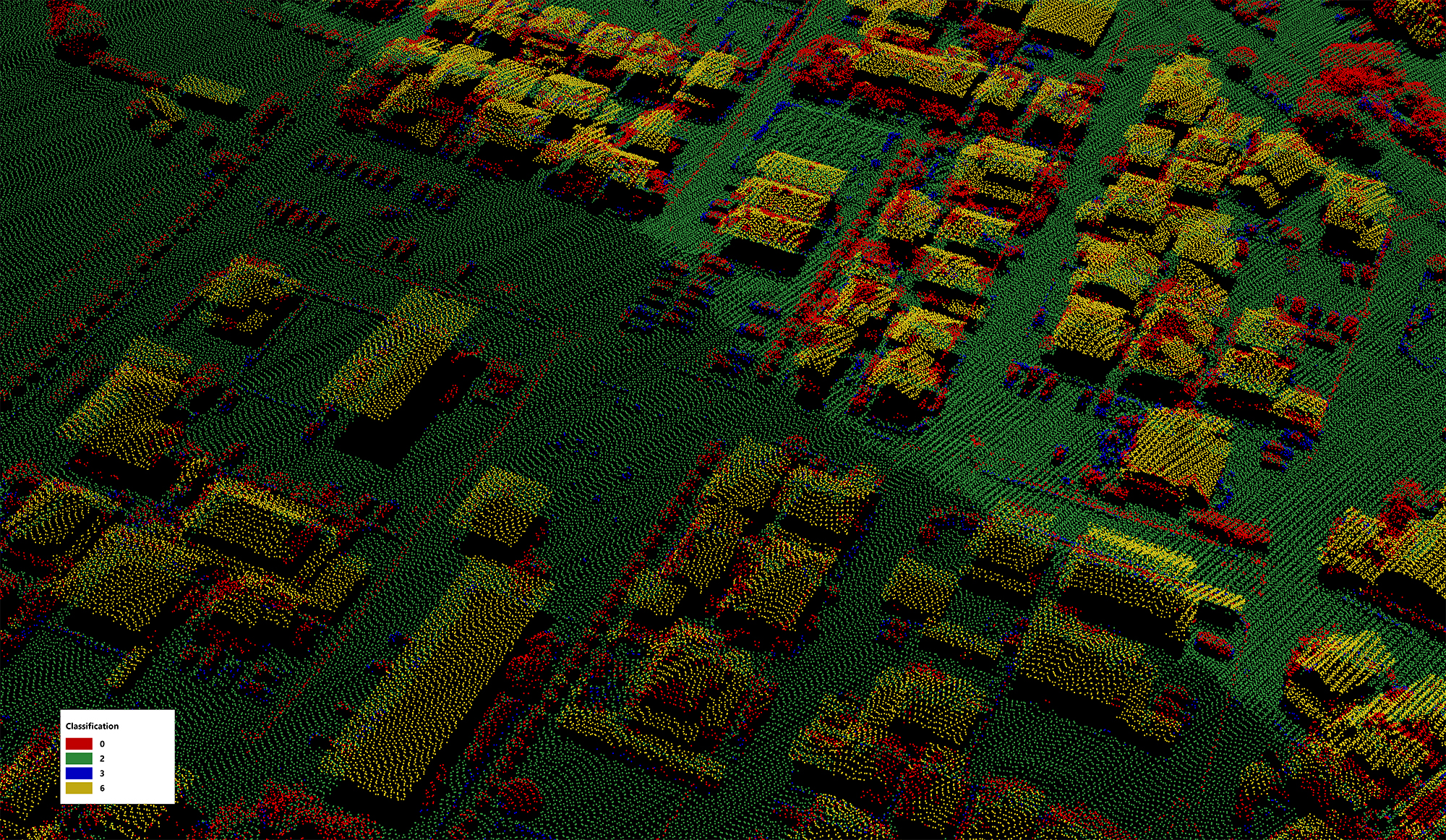
Inspecting your 3D data means knowing what data you have and assessing the content and quality of that data. QT Modeler’s indexing tool provides an interactive, visual coverage map (viewable in Google Earth and GIS software) of all data and imagery holdings. QTM can colorize and filter point clouds by point-level attributes, interrogate individual point attributes, compare elevations to known control points, and provide powerful statistical analysis (e.g., point density maps). Images on right: Point cloud with coloration by classification attribute (left side) and height coloration (right side). Use slider to compare.
Edit
Interactively clean up and edit 3D data
QT Modeler’s powerful 3D editing tools range from simple cutting and cropping, to point cloud attribute filtering, reclassification, and editing buffers around linear vectors. While many of these tools work equally well on point clouds and surface models, QTM’s point cloud editing tools make quick work of initial point cloud cleanup – removing noise, correcting/converting georegistration, automatic point cloud classification, etc. These tools are largely intuitive, visual, interactive, and very fast. Image on right: Point cloud and QT Modeler’s selection area and floating editing toolbar.
Extract
Building extraction and point cloud classification
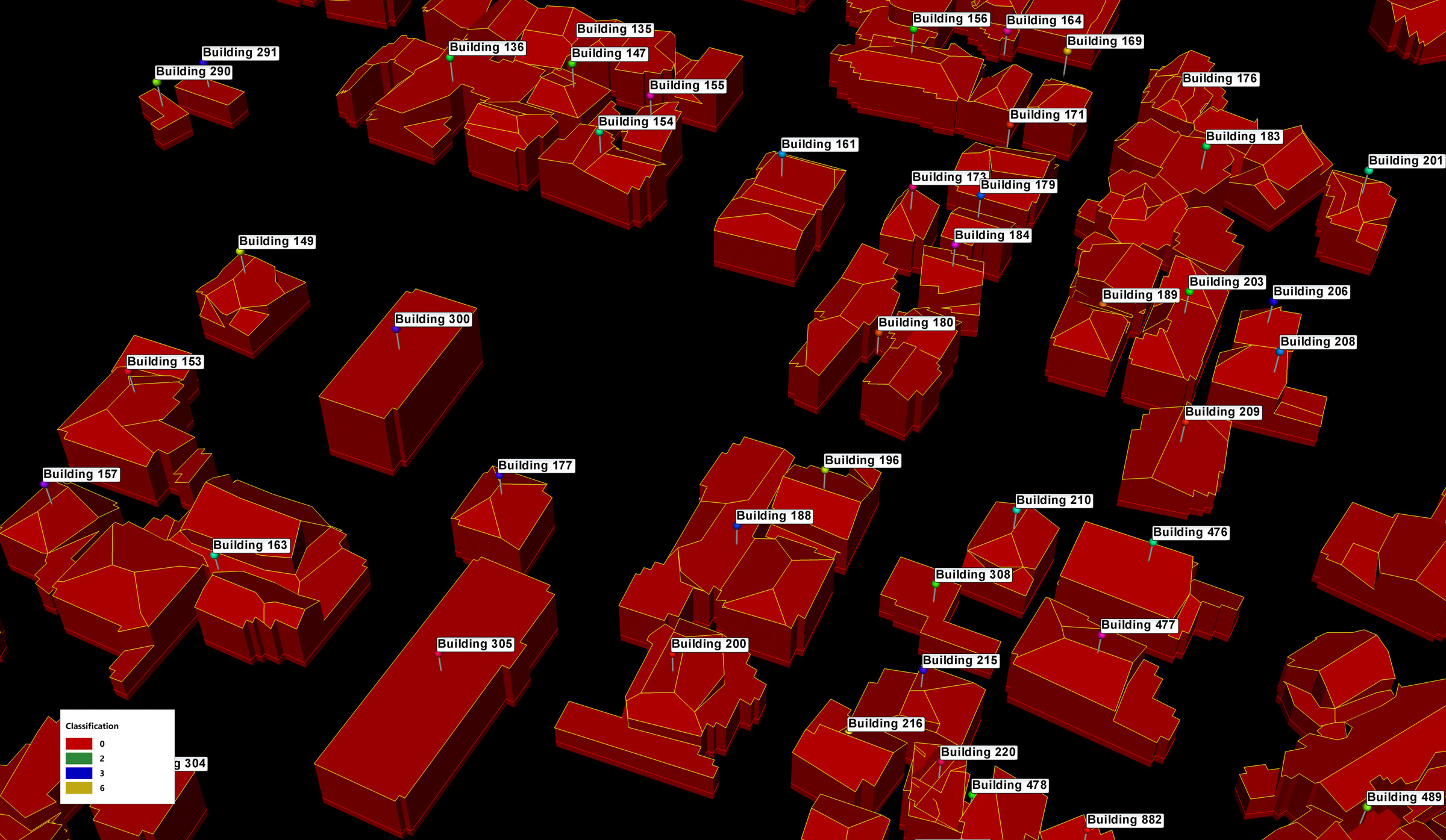
QT Modeler’s Classification and Extraction tool automatically classifies point clouds, extracts building footprints and roof vectors, generates building centroids, and creates a Digital Surface Model (DSM) and Digital Terrain Model (DTM, aka “Bare Earth) – all with a few button clicks. QTM’s manual editing tools make building cleanup a breeze. Extracted building products can be easily exported as SHP and/or KML/KMZ and DSM/DTM can be exported as GeoTIFF DEM. Images on right: Point cloud that QTM automatically classified with extracted buildings and building centroids. Use slider to compare.
Analyze
Critical analysis to inform decisions
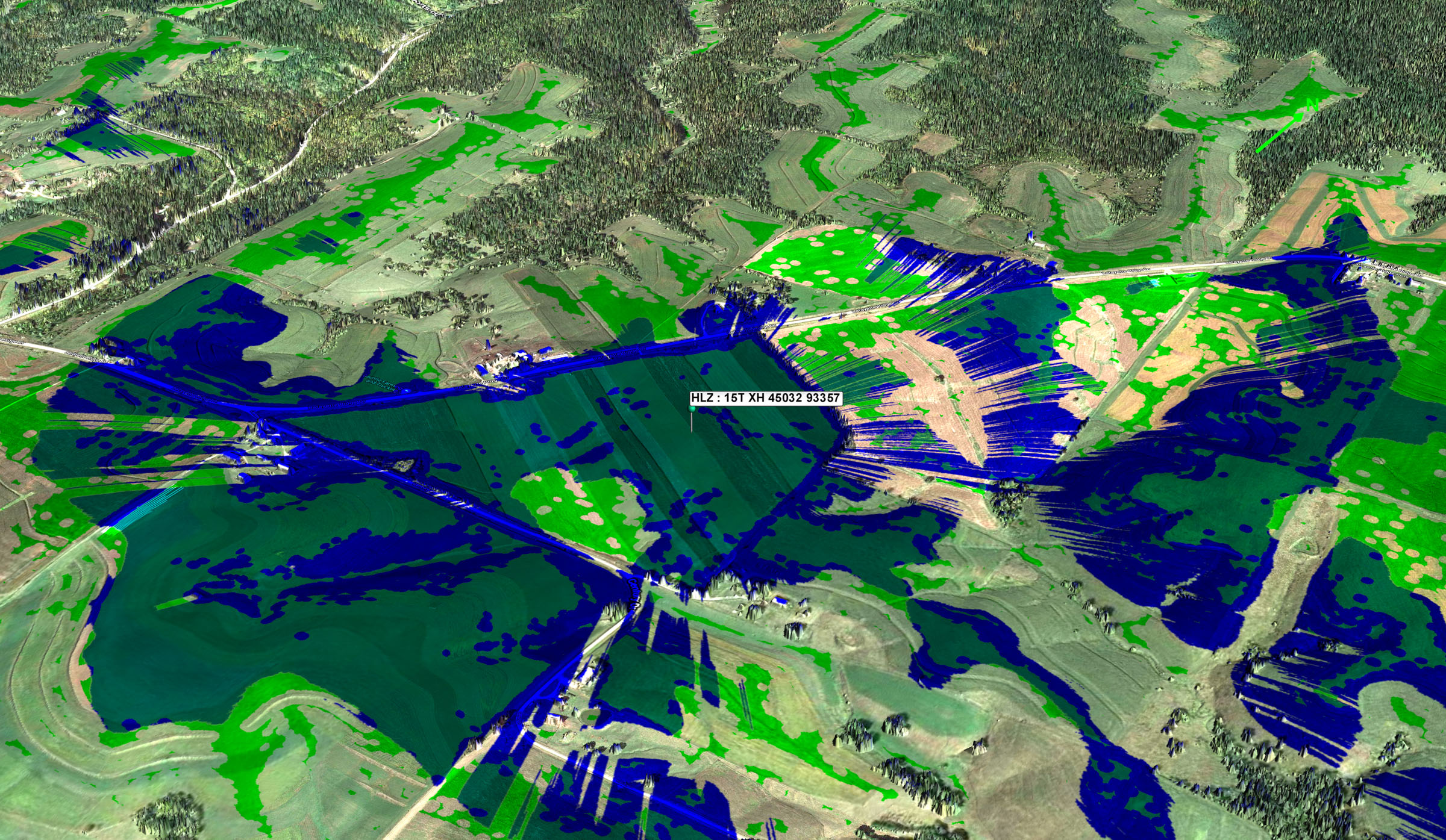
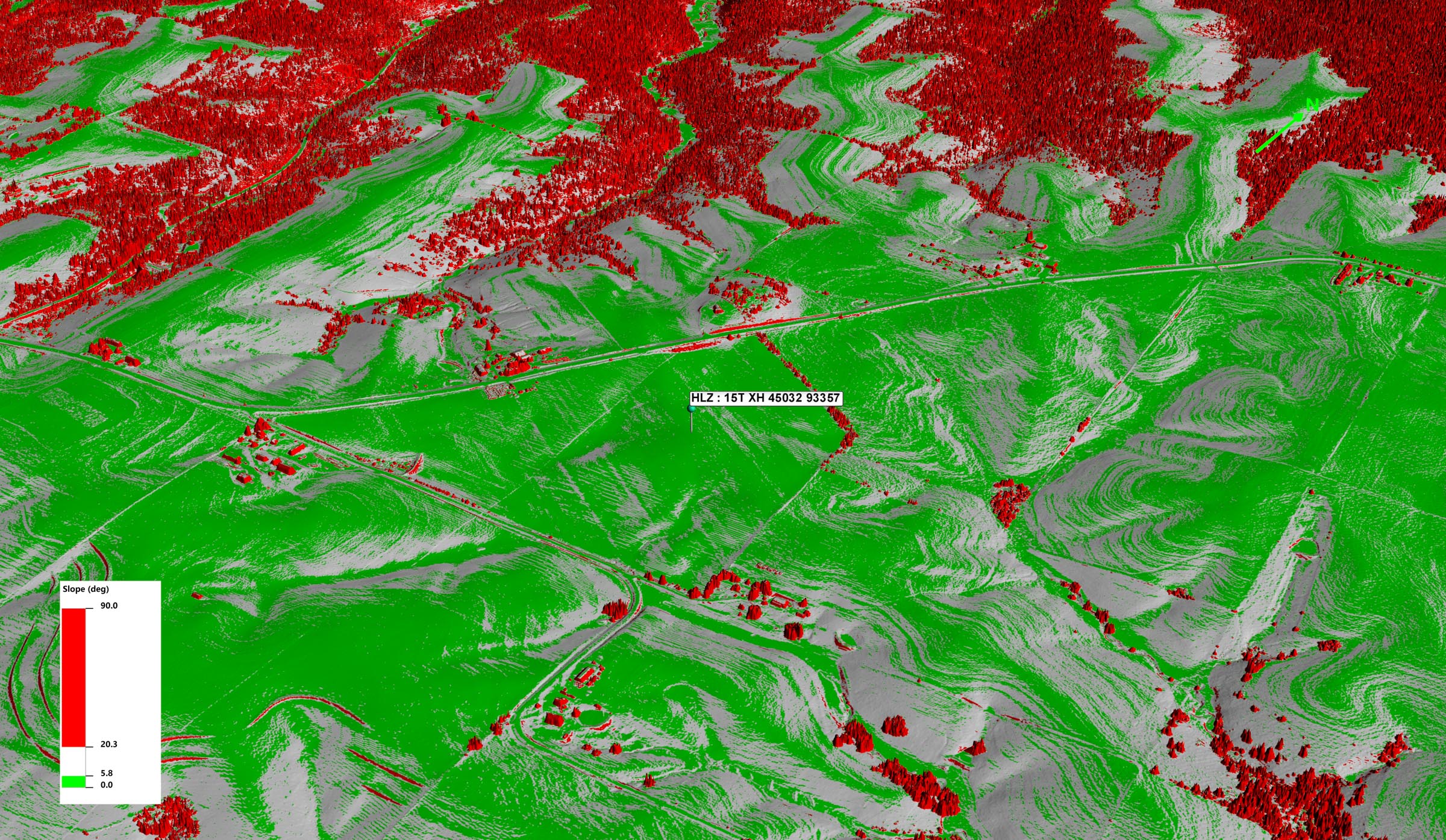
QT Modeler offers a vast array of 3D geospatial analysis tools. They range from basic 3D measurement tools, to Line of Sight (USA version only), slope analysis, Helicopter Landing Zone (HLZ) analysis, Flood analysis, volumetrics, and communications analysis. Hard core point cloud users will find powerful statistical analysis tools, point level attribute analysis/filtering. QTM’s analysis results can answer questions, assist in decision making, and contribute to planning. The questions being asked and decisions being made will vary widely between user sectors, but a consistent theme is that the analysis must be fast, accurate, interactive, easy to learn, and easy to share with others. Quick Terrain Modeler is all of these things. Images on right: Surface model (DSM) with color imagery and merged HLZ/Line of Sight analysis layers (left side) and slope analysis (right side). Use slider to compare.
Share
Move data, analysis, and annotations to other platforms
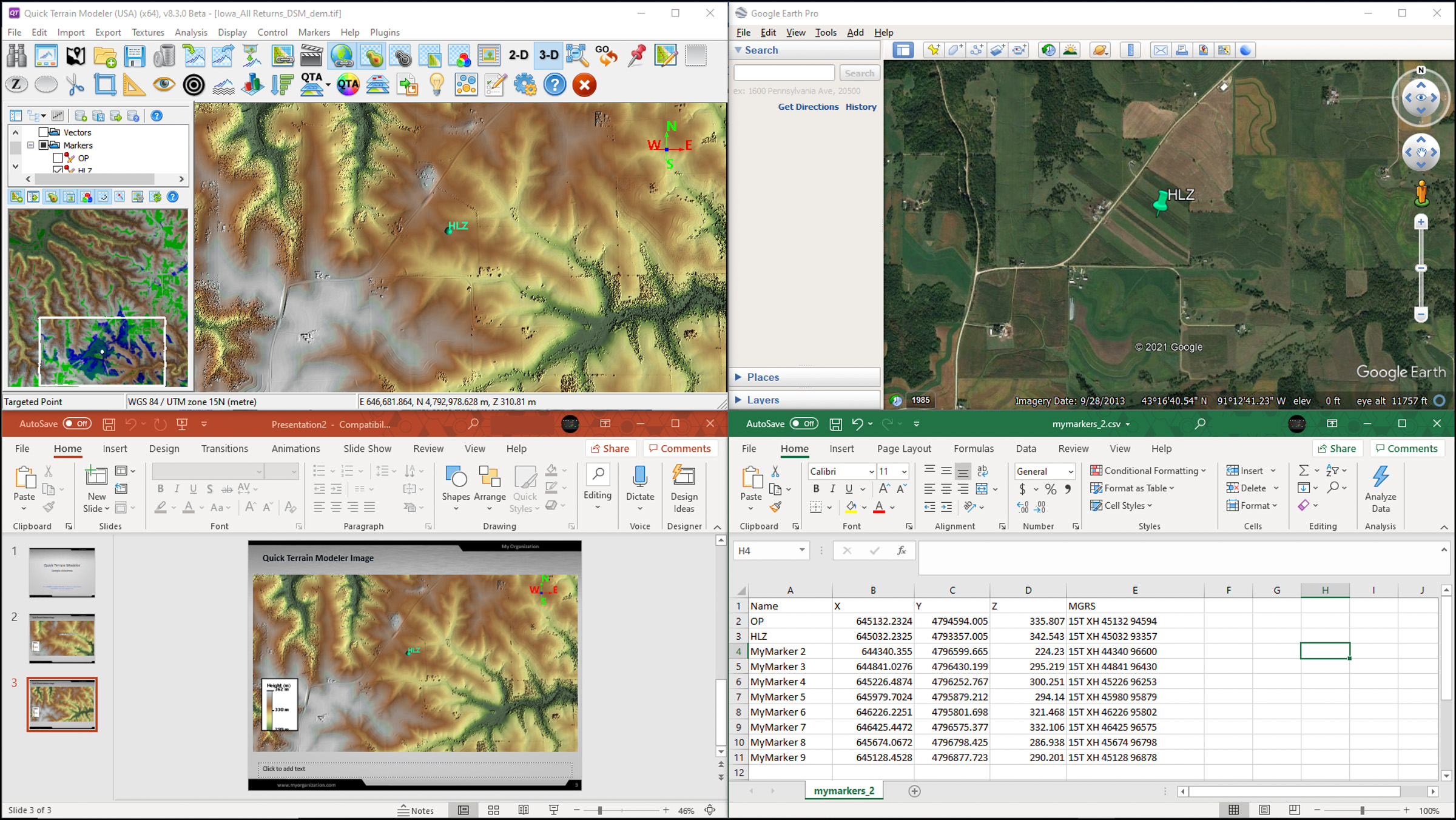
QT Modeler is likely just one tool in your geospatial toolbox. Results almost always need to be shared and opened in other software packages. Quick Terrain Modeler offers a wide variety of export options that send compatible files to GIS, Imagery, CAD, PowerPoint, Google Earth, and many other software packages. In addition, Applied Imagery makes a free companion software, the Quick Terrain Reader, that will enable colleagues to view entire 3D projects (created in QT Modeler) and experience the same immersive and interactive 3D visualization that the Quick Terrain Modeler offers. Image on right (clockwise from upper left): QT Modeler, exported products and synchronization to Google Earth, exported markers (points) to Excel, exported image to PowerPoint.
Discover
Easy tools to find, document, and manage data
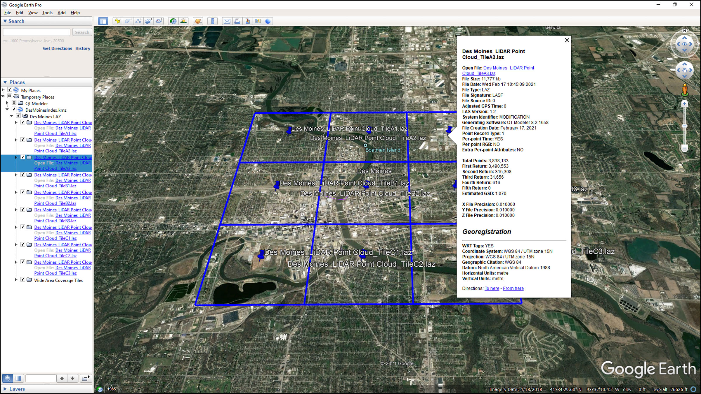
For geospatial professionals, there is no shortage of data. The challenge is to find the data you need, when you need it. Searching multiple directories, multiple drives, and/or multiple networks for relevant data is time consuming and unproductive. Quick Terrain Modeler contains tools to assist not only in organizing and indexing your geospatial holdings, but also to help find data “on the fly” – as you are working in a time-constrained environment. Image on right: QT Modeler’s index displayed in Google Earth, showing LiDAR data coverage and metadata.
Produce
Annotate your 3D scene to communicate with others
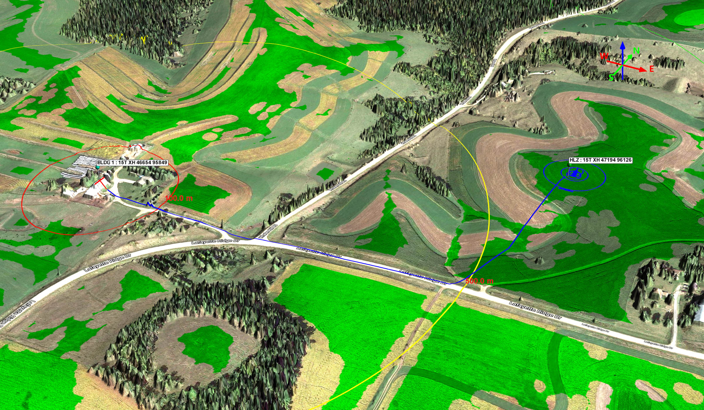
LiDAR point clouds and DEM’s are wonderful achievements by themselves, but ultimately the data was collected to assist in planning and decision making. For those users whose responsibility is to exploit LiDAR, you know that showing someone a point cloud or DEM is not enough. What is required is a standard product in a format that the end user can understand and use. Most typically, this means highly annotated PowerPoint presentations, Range Rings, Gridded Reference Graphics (GRG’s), routes exported to navigation devices, AVI movies, and other standard products. Image on right: Annotated 3D scene – markers, range rings, route, stencils (scale aircraft drawing), color imagery/map hybrid overlay, HLZ analysis layer, 3D north arrow. All coordinates converted to and displayed as MGRS.