
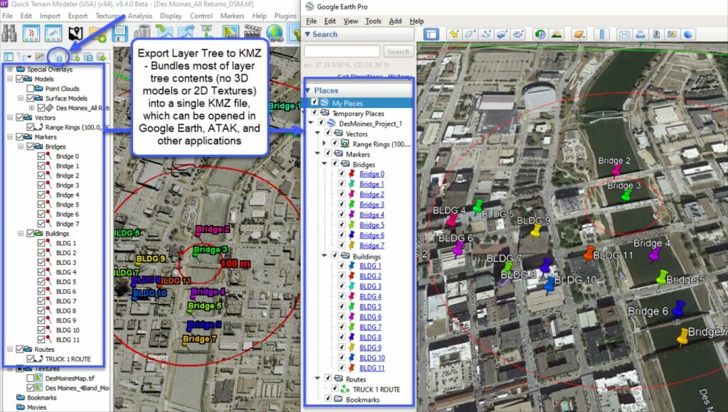
We have just posted 4 new tutorial videos. The first is an overview tutorial on QTM’s Above Ground Level (AGL) analyst. This is a very useful, multi-purpose tool that can generate bare earth as well as tag every point with an AGL value and remove points based on that value (i.e., “peel back” foliage in rugged terrain). The other three tutorials offer a 3-part overview of QT Modeler in the context of photogrammetric UAS (drone) surveys. Enjoy!
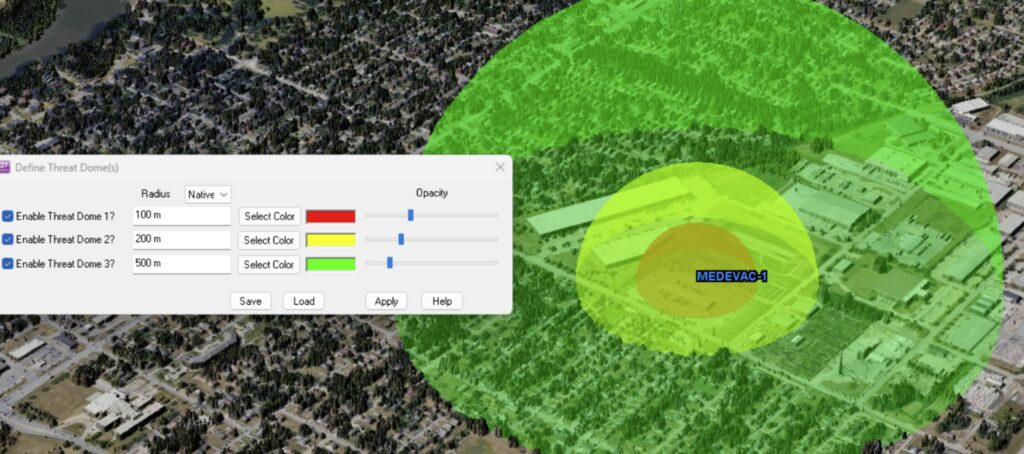
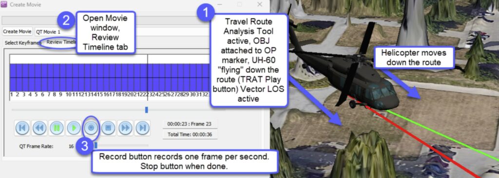
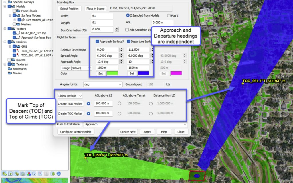
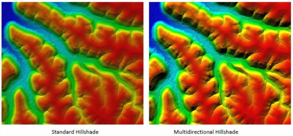
Applied Imagery is pleased to announce the release of QT Modeler v8.1.0. This is a huge release for us, adding some extremely powerful point cloud classification and feature extraction tools, totally revamping how textures (2D Imagery files) are loaded, and upgrading the interfaces of any tool that has a palette in it (e.g., height color, slope analysis). DoD users will like the new GRG tool. Watch the video for more info!
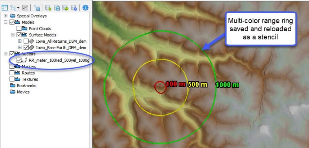
Quick Terrain Modeler version 8.0.7.2 is now available. New features include an enhanced Point Finder, virtual grid lines overlay, and other enhancements. Please contact Duane Snyder at (301) 589-4446 or dsnyder@appliedimagery.com to upgrade.
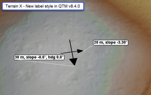
Applied Imagery is very close to the release of QT Modeler v8.0.7.1. Feel free to check out the new features that are coming in our What’s New video.

We just added a “What’s New” video for Quick Terrain Modeler v8.0.7. You can view the video here: What’s New QTM v807